A Collaboration between LDEO (Columbia University, USA) and GINR and Asiaq (Greenland)
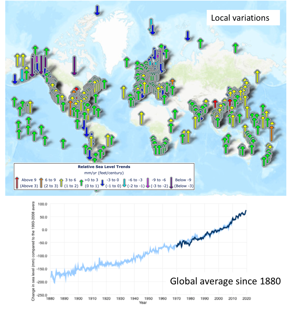
As ice melts around the world, sea level will rise in many places and fall in some. Because Greenland is very close to the changing ice, the land will rise and sea level will fall, affecting both humans and marine life.
Community responses to changing sea level depend on accurate, location-specific knowledge of the present-day coastal environment and how it is predicted to change. Given the economic, mining, natural resources, and infrastructure development occurring in Greenland there is an urgent need to better understand and communicate the present and future sea level around the island.
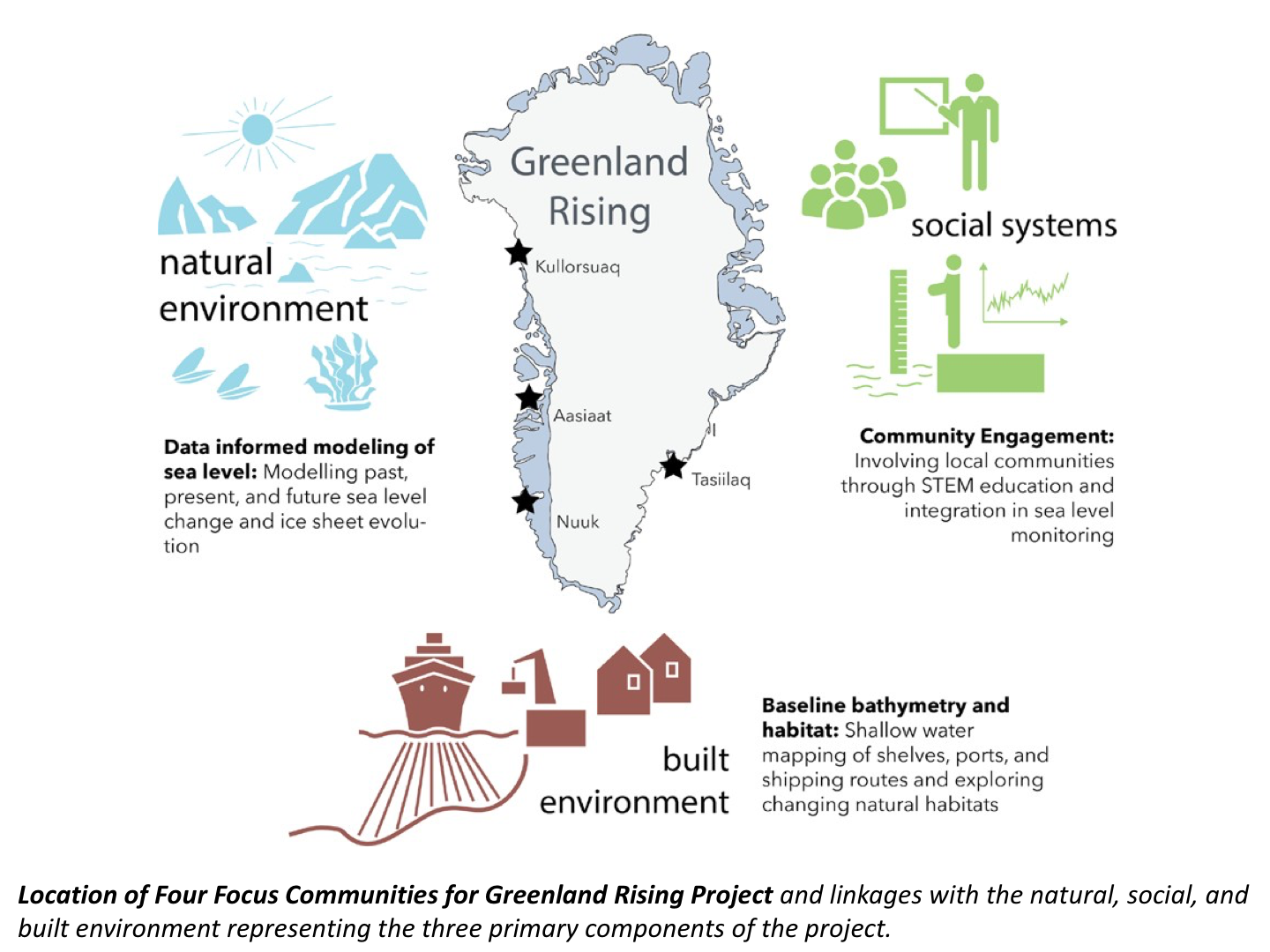
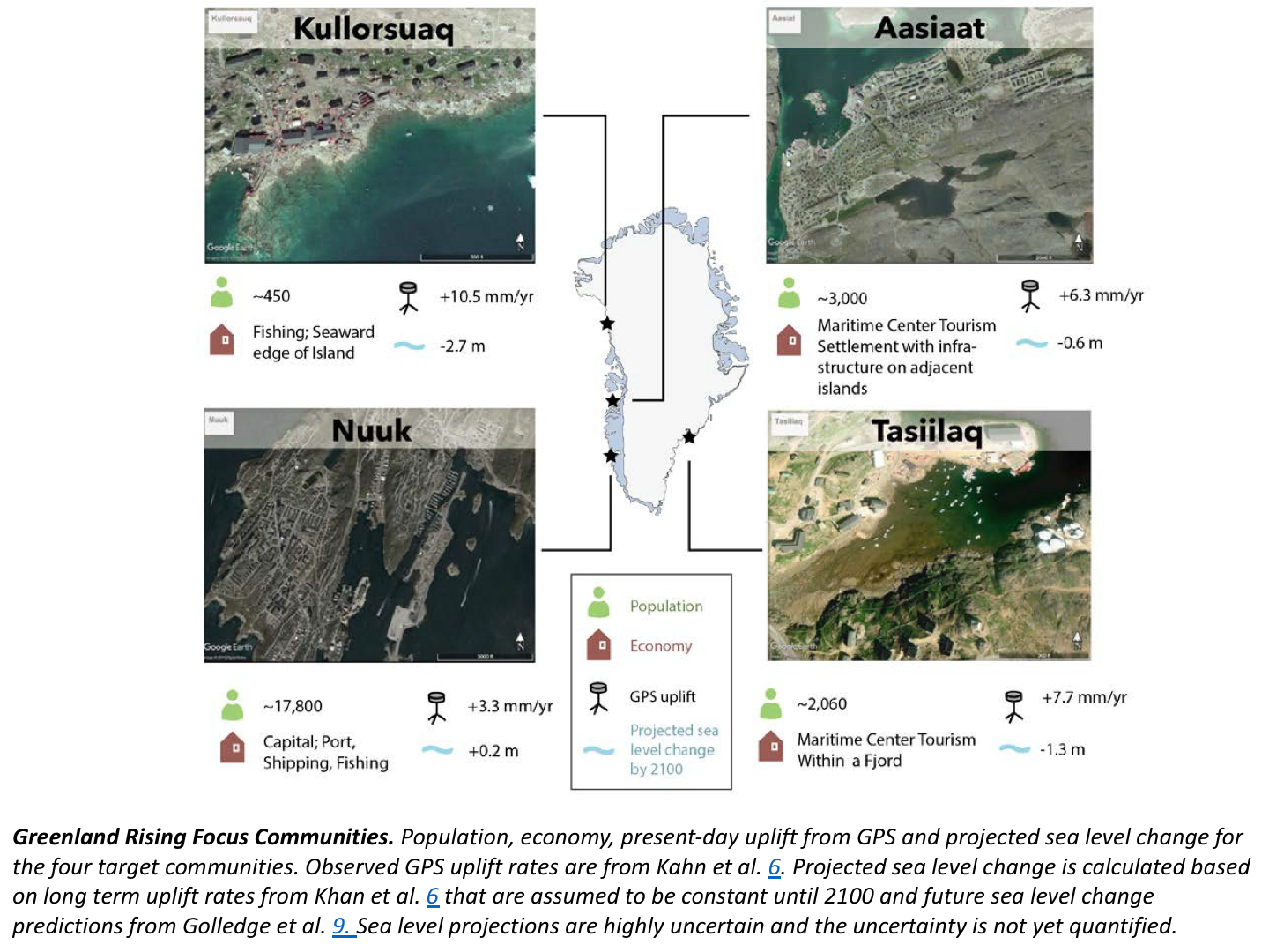
A joint US-Greenlandic team with the new NSF project has identified four key Greenlandic communities with different infrastructure that will experience different future sea levels. With a particular focus on these four communities this project will develop better models of how Greenland will rise and the sea level change, as well as mapping shallow water environments to determine what habitats and coastal routes will shift. Together these new predictions of future sea level change and mapping of seafloor habitats will improve the Greenlandic communities’ capacity to respond. This integrated approach will serve as a template for developing a strategy for communities to respond to the changing ice in the Arctic and around the globe.
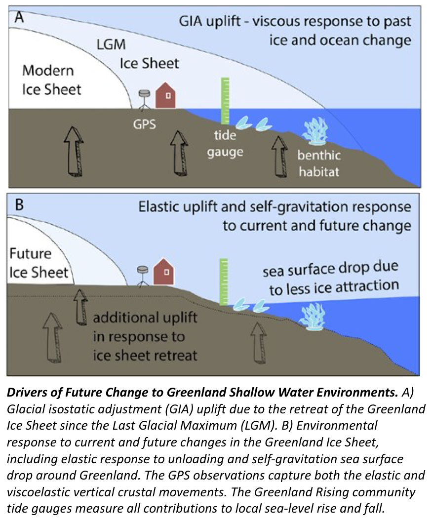
Sea level changes throughout the Arctic will be the combined response of the solid Earth (uplift or subsidence) and gravity field to changes in past, present, and future glaciers and ice sheets. Due to the adjacent ice sheet, the signals of shallow water change in Greenland will be large - the Greenland GPS Network (GNET) has documented uplift rates up to 23 mm/yr and subsidence rates of 5 mm/year in the southwest.
The goal of the Greenland Rising project is to bring together a convergent team focusing for the first time on the natural, social, and built environment of four different Arctic communities proximal to a changing ice sheet. With a focus on these four communities, the team will i) use state of the art technologies to map shallow water environment and habitats ii) develop data-informed models and projections of how sea level has responded to changing ice in the past, present and future and iii) partner with local communities in both collecting the data needed to improve the sea level models and the baseline bathymetric mapping to identify hot spots for future change where new infrastructure, fisheries, and other marine use will be susceptible to change.